Case study · Research · GIS
Flood risk mapping of Lagos Island
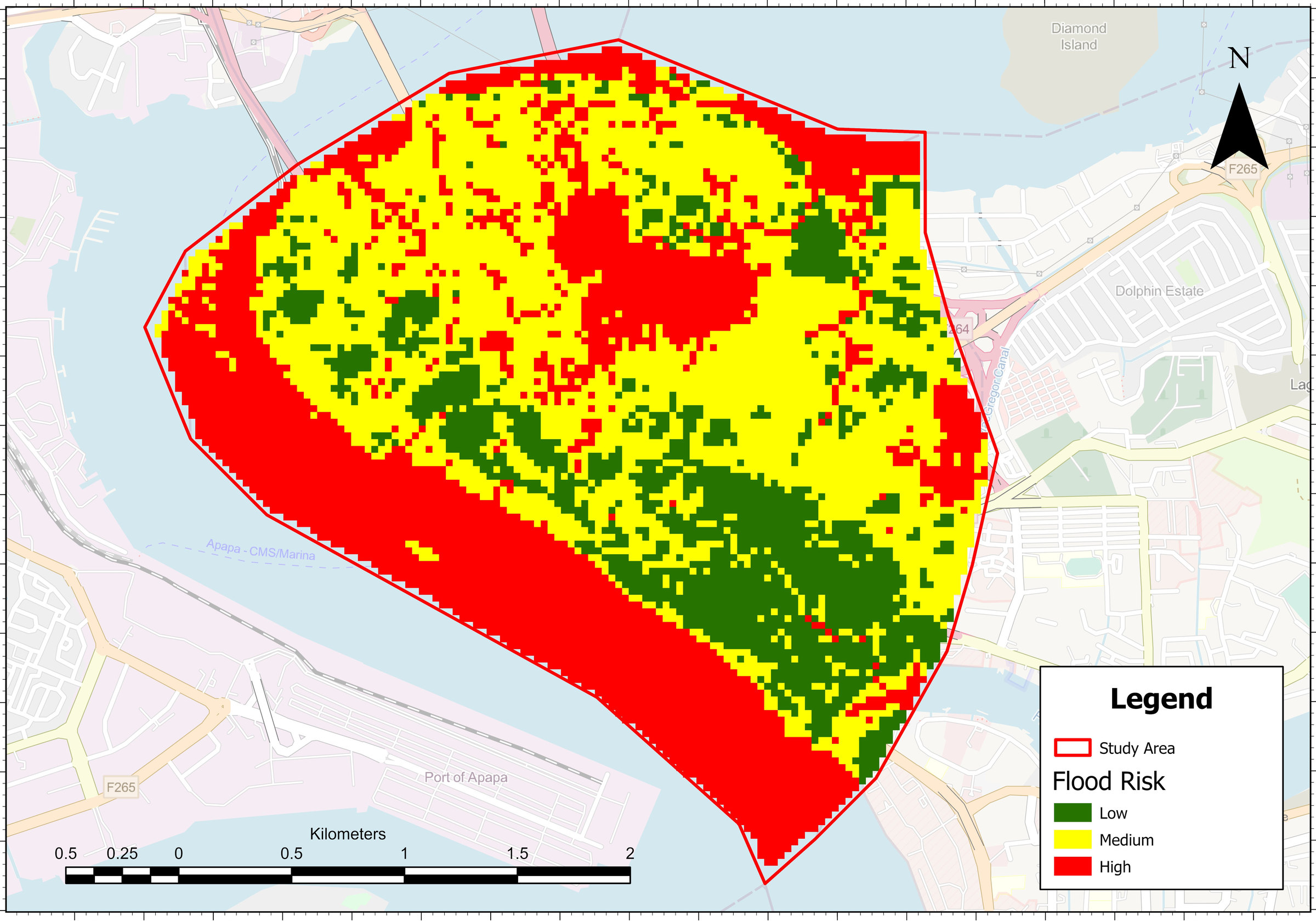
Flooding is a yearly problem on Lagos Island. For my study, I mapped flood risk across the Local Government Area in ArcGIS Pro, using AHP to weight the factors that drive flooding. About a third of the area came out as high risk, mostly along the water’s edge, with a large patch in the centre of the island.
Checking it on the ground
To test the map, I went out during the rainy season and checked 20 random points. 17 matched what the map predicted, 2 were a partial match, and only 1 didn’t flood where the map said it would.
Where it’s going
The map is part of my paper on flood risk vulnerability in Lagos Island, which is currently under review.